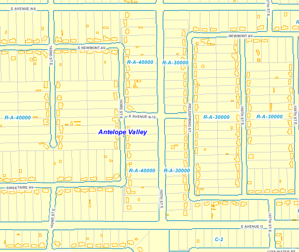
Building Outlines (2020)
Building Outlines (Representations) – All buildings (not under construction or in ruin) that are over 400 sq. feet in size (200 sq. feet min size in the City of Los Angeles). Data was acquired from the stereo pairs from the 2020 LAR-IAC6 ortho imagery. They were created by Pictometry/EagleView (our oblique imagery vendor).
Extensive quality control was performed to make sure of the accuracy of the building outlines in relation to other GIS layers including the parcel layer; however it is not perfect.
No other data about the building exists (at this time) except that each enclosed building representation polygon shall contain a single “z” (elevation) attribute representing the highest point on the building, excluding flagpoles, chimneys, and other features smaller than 4 square feet. So use this for reference purposes only.
The planimetric features (building outlines/representations) are topologically correct and meet the American Society for Photogrammetry and Remote Sensing (ASPRS) accuracy standards for large scale class 1 maps for 1” = 100’ (and 1” = 200’ for some areas) mapping in order to be incorporated into existing GIS systems.

For even more information on Building Outlines - click here.